To your top left the black & white chessball helps you to navigate home, find hints and other links. Hover in and out to show the navigation items!
Top Right and Bottom Right you either find + and – icons to navigate pages (top) and chapters (bottom), or other (self-explaining) Navigation Items. Hoevering the icons tells you also what they do. If no navigation at all appears, use scrolling!
Claimed to have been first visited in 512 by the monk St. Brendan and 14 others, along with later reports up to 1772.
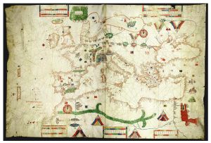
Antillia (or Antilia) is a phantom island that was reputed, during the 15th-century age of exploration, to lie in the Atlantic Ocean, far to the west of Portugal and Spain. The island also went by the name of Isle of Seven Cities (Ilha das Sete Cidades in Portuguese, Isla de
An island just to the east of the Flemish Cap; it was believed to exist into the 19th century, during which cartographers discussed it as a possible midway point for the Transatlantic telegraph cable.
Said to lie in the Atlantic Ocean west of Ireland. Irish myths described it as cloaked in mist except for one day every seven years, when it became visible but still could not be reached.
A crescent-shaped island in the North Atlantic that does not appear to exist; however, there is a crescent-shaped group of seamounts 120 feet deep near its described location.
A magnetic, black island at the exact Magnetic north, invented as an explanation for why all compasses point north.
This island was originally noted on maps in 1424, originating from popular legend of devils and demons attacking ships that went into the area, but the island was subsequently removed because it obviously did not exist. The island, often drawn to the north of the mythical Antillia, was purportedly full
A small island to the west of the mythical Antillia (see Antillia above).
Gaspar Frutuoso noted its discovery by João Vaz Corte-Real in 1472 in Saudades da Terra.
Probably a relocated version of the island of Satanazes (see island below).
An island near the coast of Africa, roughly 1,000 kilometres (620 miles) east-northeast of Ascension Island and possibly confused with the same latitude Annobón Island.
A pair of phantom islands to the east of the Marshall Islands.
Discovered in the early 16th century by Spain, but mysteriously vanished sometime during the 17th century. While no dominant theory holds, it is possible that the island submerged due to tectonic movements, supported by the existence of a seamount at 22°38.76′N 90°51.3′W / 22.64600°N 90.8550°W and the nearby Scorpion Reef.
Another island on the Zeno map, possibly a renamed Iceland.
An island appearing on the Zeno map at the current location of Labrador.
An island to the west of Greenland, perhaps a misreading of the island’s name, or Baffin Island.
Described by Francis Drake, who reported harbouring there during his circumnavigation. Not found by subsequent explorers; in 1939 Felix Riesenberg suggested Pactolus Bank as a possible remnant, though recent surveys suggest the Bank may itself be a phantom feature.
Found in the waters near Greenland, in which Martin Frobisher, the leader of the island-finding expedition, probably made a mistake in dead reckoning and mistook optical effects near Greenland for a new island.
Saxemberg was a phantom island believed to have existed in the South Atlantic. It appeared intermittently on charts between the 17th and the 19th centuries. Saxemberg was reportedly discovered by Dutch seafarer John Lindestz Lindeman in 1670. Lindeman reported the island’s coordinates as 30°45′S 19°40′WCoordinates: 30°45′S 19°40′W.[1][2] Lindeman made a
In 1683, Ambrose Cowley reported an unknown island where he thought the Falklands were, but his location was 4 degrees to the north of the Falkland Islands. While it is possible that he made a mistake in seeing a nonexistent island, it is more likely he saw one of the
It was sighted in 1687 by Edward Davis, a pirate who was carrying out raids on Spanish settlements along the coast of Mexico, Peru, and Chile, while he was sailing in the Pacific Ocean southwards from the Galapagos Islands towards Cape Horn. He saw a low sandy island and in
A mythical island near Ambon in the East Indies purportedly destroyed by a volcanic eruption.
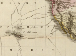
Since the late 17th century up to the early 19th century, Pacific Ocean charts registered an island named Dona Maria de Lajara, or de Laxara, or even Maria Laxar around 27 degrees North latitude and 140 West from Greenwich longitude (that is East-northeast from Hawaii). As Gemelli wrote, such an
Juan de Lisboa is a phantom island in the Western Indian Ocean allegedly located southeast of Madagascar. It was reported on maps and charts of the 17th and 18th centuries, sometimes depicted alongside another phantom island, dos Romeiros (or Pomeri).
A nonexistent island in Lake Superior referenced in the 1783 Treaty of Paris.
Discovered by Spanish merchant ship Aurora, currently thought to be just Shag Rocks.
Another phantom, small island to the west of New Caledonia that was recorded on many maps until 2012, when a surveying ship passed by and disproved its existence. The current leading explanation is that the island was a raft of buoyant pumice from a recent nearby seamount eruption.
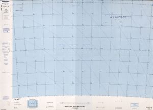
Approx. 83°W, 37°S (southwest of Robinson Crusoe Island), noted as “position doubtful” in Operational Navigation Chart[7] of the United States Department of Defense.
An island near the De Long Islands, north of Russia, that probably did exist but was destroyed due to coastal erosion.
Probably fog banks and icebergs (see Dougherty Island above); the abyssal plain below it was named Emerald Plain, however, in recognition of the nonexistent island.
Unknown odd island near Antarctica, which captain Benjamin Morrell of the ship Wasp saw while traveling north from Antarctica. He thought it to be the Antarctic Peninsula (then called New South Greenland), but his reported location during the voyage, while perfectly copying the expected path for traveling up the peninsula,
A group of islands between Emerald Island and Dougherty Island, both of which are nonexistent. Probably a group of icebergs together.
A fictional island widely believed during the 19th century to be to the southwest of Tasmania. While not found by numerous expeditions in 1840, 1889, 1902, 1909, and 1912, the island was not officially removed from nautical charts until 1904.
Because it is near Antarctica, it is likely that the discoverer, Captain Dougherty, and future explorers who confirmed it, saw fog banks and icebergs conveniently situated in the right place and time.
A shoal in the eastern Pacific Ocean.
Another nonexistent reef in the Line Islands (in fact Line Islands are more than 2,000 miles (3,200 kilometres) away), slightly to the southwest-west of the phantom island, Jupiter Reef. It is a setting for Jules Verne’s book In Search of the Castaways.
Sarah Ann Island (also spelled Sarah Anne) is a vanished island, previously located at 4°0′N 154°22′WCoordinates: 4°0′N 154°22′W[1] (though sometimes listed at about 175° W[2]). It was discovered in 1858 and claimed by an American guano firm, under the Guano Islands Act (as Sarah Anne). A search in 1932 by
North of Zemlya Frantsa-Iosifa, named after August Heinrich Petermann.
To the west of the Hawaiian Islands, Schjetman Reef was originally found in 1868 to be an island 1.5 nautical miles long and 0.5 nautical miles wide. Later searches in 1880, 1923, and 1924 could not find the island.
Nonexistent reef in the Line Islands (in fact Line Islands are more than 2,000 miles (3,200 kilometres) away), to the south of the also nonexistent Ernest Legouve Reef (see above).
Podesta is a phantom island reported at 32°14′S 89°08′W Coordinates: 32°14′S 89°08′W by the Italian Captain Pinocchio of the vessel Barone Podestà (Hereward Carrington, Carrington Collection, page 21) in 1879 claiming it to be just over a kilometre in circumference located 1390 km due west of El Quisco, Chile. It
Found in 1884 by Johan Otto Polter, who, in four later expeditions through 1909, disproved the island’s existence.
An oceanic bank 400 feet (120 metres) deep off the west coast of Cape Horn, suggested as the remains of Elizabeth Island: However a 1956 search of the area turned up no shallow areas in the reported location.
This reef, part of the Line Islands, was first seen by the ship Filippo and was seen again in 1926 when both ships saw breakers in the same area, suggesting a depth of 0.6 to 0.9 metres (2.0 to 3.0 feet). Current observations show the reported location to have a
A nonexistent island off the coast of Japan to the southwest of the Shatsky Rise.
A reef supposedly found by the captain of the French ship, Ernest Legouvé, which is near the exact location of the fictional Lincoln Island, the main setting for Jules Verne’s book The Mysterious Island, also appearing in In Search of the Castaways.
J.P. Koch, together with Aage Bertelsen, was reported to have first seen Fata Morgana Land (Danish: Fata Morgana Landet) lying in the Arctic Ocean around 80°00´N 10°00´W between NE Greenland and Svalbard. This elusive land was allegedly seen as well by Lauge Koch from the air in 1933.[6]
Thought to lie off Oates Coast, East Antarctica.